Author
Nkosi Muse
Citation
Muse, Nkosi Mark MS, “An Analysis of Climate Resilience Planning in Atlanta, Georgia.” Thesis, Georgia State University, 2020. https://scholarworks.gsu.edu/geosciences_theses/141
Year Created
2020
Purpose
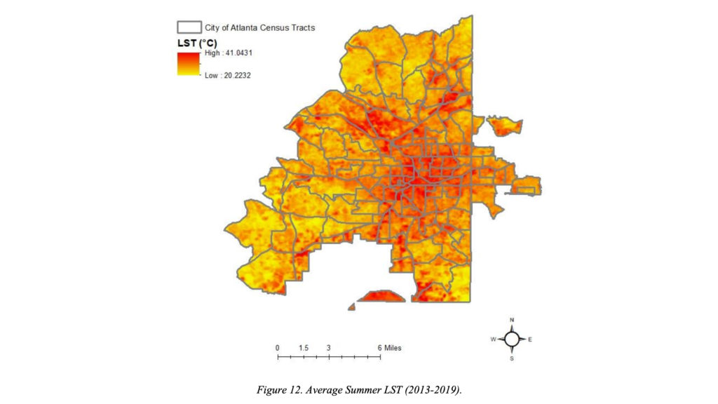
Data was accessed and aggregated to show peak land surface temperatures in Atlanta for the summers 2013-2019 and used to show what areas of the city are more vulnerable to adverse heat effects. It is also useful to observe relationships between areas with higher LST and other characteristics to identify vulnerability and other emergent variables.
Description
This is the peak Land Surface Temperature (LST) data from 2013-2019 in Atlanta, GA.
Attributes
Raster data was retrieved from the NASA/USGS Landsat 8 Satellite, equipped with Operational Land Imager (OLI) and Thermal Infrared Sensor (TIRS) instruments. Data from the satellite was downloaded by individual recorded day from the USGS Earth Explorer website, packaged with GeoTIFF images the represent each satellite band and a metadata file containing satellite thermal constants, rescaling factors, and corrections.


