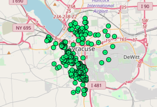
Description Unfit Properties in Syracuse Type: shapefiles Spatial Extent: Syracuse Metropolitan Statistical Area Download Data Post navigationPreviousPrevious post:Syracuse School DistrictsNextNext post:Urban Flooding Task ForceRelated PostsFulton County building footprints – Atlanta clipNovember 19, 2021Fulton County Building FootprintsNovember 19, 2021Atlanta Emergency Centers Layer PackageNovember 19, 2021Atlanta School LocationsNovember 19, 2021Atlanta Homeowners and Renters, by Census Block GroupNovember 19, 2021Atlanta Primary Language and Limited English Households, by Census Block GroupNovember 19, 2021