Authors
- Drew Canfield – University at Buffalo
- Zoe Hamstead – University at Buffalo
Purpose
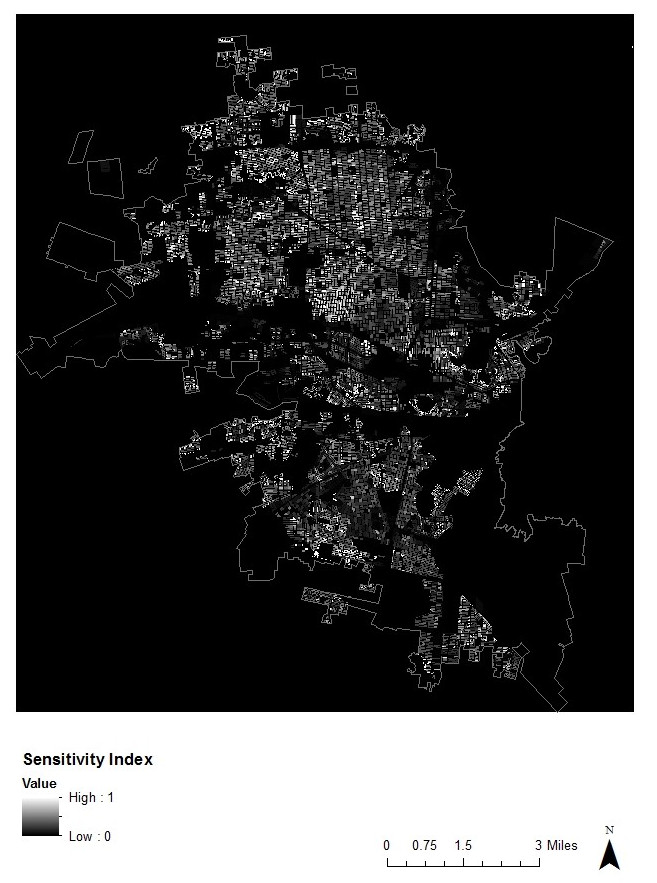
The Hermosillo Heat Sensitivity Index Map indicates the normalized (between low (0) and high (1)) spatial concentration of the population most sensitive to thermal extremes. In Hermosillo those sensitive populations include: the population below the age of 5, the population 65 years old and above, houses without electricity, houses without tap water, houses with at least 1 vehicle, adults 15 years old and above who are illiterate, the population without health service, the unemployed population, and the disabled population.
Description
The Hermosillo Heat Sensitivity Index Map was created by combining the Disability Index, Quality of Life Index (houses with no electric or tap water), Age Index (<5 years and >=65 years), Education/Literacy Index, Health Service Access, Vehicle Access Index, and Economic Index ((Normalized Disability + Normalized Age + Normalized Quality of Life + Normalized Health Service Access+ Normalized Vehicle Access + Normalized Education) / 7) and indexing values between 0 (low) and 1 (high).
All census data used to construct population indices was derived from the 2010 Sonora Census.
The USO 2010 (Hermosillo Land Use Classification Map) was used to determine population residence.
Attributes
Sensitivity to heat index